
📚 Exam by Category
▾
Objective Questions

Latest USET Geography Exam Question (Objective Questions), MCQ in English

Subjects : Geography

Question Bank Uttarakhand SET Geography Exam - English
Back to Exam

Geography

Question 1Single Answer
Which one of the following mountains is formed due to convergence of one oceanic and one continental plate?
  1. A
    Urals
  2. B
    Alps
  3. C
    Andes
  4. D
    Appalachian
Question 2Single Answer
Which one of the following processes is responsible for the weathering of rocks in  a Karst region?
  1. A
    Hydrolysis
  2. B
    Carbonation
  3. C
    Oxidation
  4. D
    Scree formation
Question 3Single Answer
Match List-I with the List –II and select the correct answer from the code given below:
List –I                              List –II
RIver                              Types of delets 

I. Nile                              A. EstuarineII  
II. Mississippi                  B. Arcuate
III Ganga                         C. Bird foot
IV Tiber                           D. Cuspate 
Codes:
  1. A
    (i)          (ii)           (iii)          (iv)
    B            C             D            A 
  2. B
    D            B               A           C 
  3. C
    A            D             B            C 
  4. D
    B                C               A           D
Question 4Single Answer
The term panplane refers to
  1. A
    A level surface formed by wind erosion
  2. B
    A plane formed by joining of flood-plains
  3. C
    A level surface formed by the fluvial cycle at the old age.
  4. D
    A level plain formed by human intervention
Question 5Single Answer
The statement “The present is the key to the past” was made by
  1. A
    Walther Penck
  2. B
     W. M. Davis
  3. C
    Huntington
  4. D
    James Hutton
Question 6Single Answer
A band of wind called ‘Jet stream’ is found in.
  1. A
    Lower Troposphere
  2. B
    Middle Troposphere
  3. C
    Upper Troposphere
  4. D
    Whole Troposphere
Question 7Single Answer
‘Negative southern Oscillation Index’ refers to which of the following?
  1. A
    Favourable condition for El Nino
  2. B
    Favourable condition for La Nina
  3. C
    Favourable condition both for El Nino
  4. D
    Unfavourable condition both for El Nini and La Nina
Question 8Single Answer
In which of the following areas, the main centre of ‘Hurricane Mathew’ that occurred in Caribbean Sea in the 1st week of October, 2016 was located?
  1. A
    Florida
  2. B
    Georgia
  3. C
    South Carolina
  4. D
    South- West Haitti
Question 9Single Answer
In Indian Ocean between 0o – 10o N and 0o – 10oS latitudinal zones, the temperature variations is of about –
  1. A
    3oC
  2. B
    2oC
  3. C
    1oC
  4. D
    0oC
Question 10Single Answer
The general depth of abyssal plains varies between
  1. A
    1000 – 6000 metres
  2. B
    2000 – 6000 metres
  3. C
    3000 – 6000 metres
  4. D
    4000 – 6000 metres
Question 11Single Answer
Match List-I with the List –II and select the correct answer from the code given below
:List –I                                   List –II
(Ocean Deeps)                           (Location)
I.Challenger                    A. South pacific
II.Aldrich                         B  North Atlantic
III Romanche                  C.  North PacificIV NaresD. South Atlantic
IV.Nares                          D South Atlanitc
Codes:
  1. A
    (i)           (ii)            (iii)           (iv)
    C            A              D              B
  2. B
    D           C            B             A
  3. C
    A             B               C               D
  4. D
    B             D                 A             C
Question 12Single Answer
Tropical Evergreen Forests are found in the areas of rainfall ranging between
  1. A
    Less than 100 cms
  2. B
    100 – 200 cms
  3. C
    200 – 300 cms 
  4. D
    More than 300 cms
Question 13Single Answer
India has how many major bio-geographic regions?
  1. A
    7
  2. B
    8
  3. C
    9
  4. D
    10
Question 14Single Answer
Which one of the following countries is devoid of glossopteris flora
  1. A
    India
  2. B
    Australia
  3. C
    Norway
  4. D
    South Africa
Question 15Single Answer
Given below are two statements, one labeled as Assertion (A) and the other labeled as Reason (R). select your answer from the code given below:
Assertion (A): In the altitudinal range between 3400 metre and 4500 metre in the Himalayas Alpine forest is found.
Reason (R): Alpine forest like no human interference. 
  1. A
    Both (A) and (R) are true and (R) is the correct explanation of (A)
  2. B
    Both (A) and (R) are true but (R) is the correct explanation of (A
  3. C
    (A) is true, but (R) is false
  4. D
    (A) is false, but (R) is true
Question 16Single Answer
In describing the process of spatial interaction, geographers are most concerned with
  1. A
    Density and Dispersion
  2. B
    Diffusion and Pattern
  3. C
    Accessibility and connectivity
  4. D
    Pedestrian cities
Question 17Single Answer
Who among the following formalized the concept that there exists relationship between the spatial organization and national development?
  1. A
    Luten
  2. B
    Dickens
  3. C
    Kulklinski
  4. D
    Friedman
Question 18Single Answer
The concept of ‘paradigm’ was propounded by
  1. A
    Peet
  2. B
    Haggett
  3. C
    Kant
  4. D
    Kuhn
Question 19Single Answer
Who defined Geography as human ecology?
  1. A
    Schaefer
  2. B
    Barrows
  3. C
    Hartshorne
  4. D
    Ellen Semple 
Question 20Single Answer
The approach that some geographical facts according to Ritter, cannot be explained scientifically, is termed as
  1. A
    Locational 
  2. B
    Ecological
  3. C
    Teleological
  4. D
    Regional
Question 21Single Answer
The much of the liquid precipitation is equivalent to ten inches of snowfall at deep/near freezing temperature?
  1. A
    About 3 inches
  2. B
    About 2 inches
  3. C
    About 1 inch
  4. D
    At times about one inch and at times about two inches
Question 22Single Answer
Which one of the following letters represent the total number of settlements of a certain order served by a central place of the next higher order?
  1. A
    K
  2. B
    J
  3. C
    L
  4. D
    F
Question 23Single Answer
Who developed the theory demographic transition?
  1. A
    Zelinskey
  2. B
    Whittlesey
  3. C
    Warren Thompson
  4. D
    Ravenstein
Question 24Single Answer
Match List-I with the List –II and select the correct answer from the code given below:
List –I                                                                       List –II
(General Terms)                                                  (Definitions)
I. 
crude birth rate                                            A. Births over deaths per thousand of population
II.General fertility rate                                    B. Number of deaths per thousand of population
III. natural increase of population                  C. Ratio between number of births andnumber of females in
IV Death rate                                                D.Ratio between number of births and total population
Codes:
  1. A
    (i)         (ii)           (iii)          (Iv)
    D          C              A           B 
  2. B
    A              B             C        D
  3. C
    C           D              B         A 
  4. D
    B           A            D               C
Question 25Single Answer
The rule “size of population of nth ranking town in a region will  be 1/nth of the largest city in terms of population” was given by
  1. A
    M. Jafferson
  2. B
    J. Gattman
  3. C
    G. K. Ziph
  4. D
    C. D. Harrish and E. L. Ullman
Question 26Single Answer
When 0 – 14 and 15 -44 age groups population of a country is almost identical the growth of population would be called
  1. A
    Rapid growth
  2. B
    Slow growth
  3. C
    Zero growth
  4. D
    Negative growthn
Question 27Single Answer
Who modified the crop-combination method propounded by J.C. Weaver?
  1. A
    S.M. Rafiullah
  2. B
    Jasbir Singh
  3. C
    Doi
  4. D
    S.S. Bhatia
Question 28Single Answer
World’s largest Uranium reserves are found
  1. A
    Canada
  2. B
    Chile
  3. C
    Zaire
  4. D
    Nigeria
Question 29Single Answer
Which one of the following deserts is famous for the deposits of Nitrates?
  1. A
    Sahara
  2. B
    Gobi
  3. C
    Kalahari
  4. D
    Friedman
Question 30Single Answer
Which one of the following is credited with incorporation of concept of geographical space in the growth /Pole Theory?
  1. A
    Myrdal
  2. B
    Haggerstand
  3. C
    Boudeville
  4. D
    Friedman
Question 31Single Answer
What are the three basic aspects for spatial interaction as described in Edward Ullman’s model?
  1. A
    Human behaviour, Transferability, Convenience
  2. B
    Surplus-deficit relationship, Community specific relationship, Complementarity
  3. C
    Complementarity, Intervening Opportunity, Transferability
  4. D
    Residential Neighbourhood, Complementary, Convenience
Question 32Single Answer
The concept of cultural landscape was promoted by
  1. A
    Ratzel
  2. B
    Carl Sauer
  3. C
    Wilber Zelinsky
  4. D
    AuneBultimer
Question 33Single Answer
Match List-I with the List –II and select the correct answer from the code given below:
List –I                                   List –II
I.O.K.L Spate                       A. Role of relif featuref in the horiznoil expansion and segregation of cultures 
II. Terre and Peterson         B. Late stone age must be associated with people much like the modern tribal groups in more remote regions.
III.Richards and Subbaro    C.Values of the mountian wall are determiamd by as much as what lies boyend as by  ita own topography 
Iv. Allchin                             D.direct relationship between the claimatic changes  and the ries  of early human culturs 
Codes:
  1. A
    (i)          (ii)          (iii)          (iv)
    C            D           A             B
  2. B
    C            B               A          D
  3. C
    B           D                   C             A
  4. D
    D             A              C           B 
Question 34Single Answer
Match List-I with the List –II and select the correct answer from the code given below:
List –I                                                             List –II
(Macro Economic regions by Bhatt)       (Groups of States)
I  Southern                                              A. Maharastra and Gujarat
II North-Central                                      B. Bihar, Odisha, West Bengal and Assam
III. Eastern                                             C. Mysore, Tamil Nadu and Andhra Pradesh
IV. Western                                            D  Uttar Pradesh and Madhya
Prades
Codes: 
  1. A
    (i)            (ii)             (iii)            (iv)
    B             D                C               A 
  2. B
    C           B               D             A 
  3. C
    D           C             B           A 
  4. D
    C             D              B              A
Question 35Single Answer
Which one of the following regions separated the Great Plains of North India from the plateaus and coastal plains of the Deccan?
  1. A
    Central Highlands
  2. B
    Western Himalayas
  3. C
    Eastern Himalayas
  4. D
    Western Arid Plains
Question 36Single Answer
For which one of the following regions, the flow analysis technique is used for delineation of regions?
  1. A
    Political
  2. B
    Formal
  3. C
    Functional
  4. D
    Physiographic
Question 37Single Answer
Which one of the following authors used 1961 Census of India date to group the seven industrial categories of workers (excluding the first two categories representing the agricultural sector) into the functional types of manufacturing town, trade and transport town and service towns?
  1. A
    AmritLal
  2. B
    Qazi Ahmed
  3. C
    Ashok Mitra 
  4. D
    S. M. Rafiillah
Question 38Single Answer
Who wrote the book ‘Elements of Regional Economics’?
  1. A
    Harvey S. Perloff
  2. B
    Jean Forbes
  3. C
    AnotoniKulklinski
  4. D
    Harry W. Richardson
Question 39Single Answer
Which one of the following authors presented model that formed the basis of the planning strategy in the second plan in India?
  1. A
    Harrod 
  2. B
    Mahalanobis
  3. C
    Domer
  4. D
    Dandeker
Question 40Single Answer
The planning commission of India was set up in which year?
  1. A
    1950
  2. B
    1952
  3. C
    1960
  4. D
    1965
Question 41Single Answer
Which one of the following regions has been classified as the ‘Western Dry Region’ by the Planning Commission?
  1. A
    North Bihar Dry Region
  2. B
    Rajasthan Dry Region
  3. C
    NEFA Region
  4. D
    West Bengal Region
Question 42Single Answer
Whose portrayals epitomized the relationship of political Geography to foreign policy?
  1. A
    Adolf Hitlar
  2. B
    Winston Churchill
  3. C
    Karl Haushofer
  4. D
    Isaiah Bowman
Question 43Single Answer
Given below are two statements, one labeled as Assertion (A) and the other labeled as Reason (R). select your answer from the code given below:
Assertion (A): The Tarai region represents a marsh like landscape.
Reason (R): The Tarai region is a zone of seepage where the fine sand, silt and clay are deposited by the emerging streams.
  1. A
    Both (A) and (R) are true and (R) is the correct explanation of (A)
  2. B
    Both (A) and (R) are true but (R) is the correct explanation of (A)
  3. C
    (A) is true, but (R) is false
  4. D
    (A) is false, but (R) is true
Question 44Single Answer
Which one of the following statements is correct?
  1. A
    One Himalayas were formed due to faulting of the earth’s crust.
  2. B
    Himalayas are the oldest mountains.
  3. C
    Himalayas belong to the celedonian mountain system.
  4. D
    Himalayas have risen from the Tethys sea when the sea got compressed
Question 45Single Answer
Cumulative frequency distribution is shown by
  1. A
    Histogram
  2. B
    Frequency curve
  3. C
    Pie Diagram
  4. D
    Ogive
Question 46Single Answer
In linear regression equation, Y=a + bX, if mean of X and Y series are 23 and 94.5 respectively and slope gradient is 105, then what is the values of intercept, a in the distribution of (X, Y) series?
  1. A
    50
  2. B
    55
  3. C
    60
  4. D
    65
Question 47Single Answer
Given below are two statements, one labeled as Assertion (A) and the other labeled as Reason (R). select your answer from the code given below:
Assertion (A): Maps that are usually referring various attributes’s information are called complex thematic maps.
Reason (R): Complex Thematic Maps are used to show locations of earth’s different features and activities.
  1. A
    Both (A) and (R) are true and (R) is the correct explanation of (A)
  2. B
    Both (A) and (R) are true but (R) is the correct explanation of (A)
  3. C
    (A) is true, but (R) is false
  4. D
    (A) is false, but (R) is true
Question 48Single Answer
Match List-I with the List –II and select the correct answer from the code given below:
List –I                                   List –II
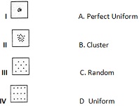
(Values of Rnstatistics )(Pattern of Distribution)
I.
O.< 0.5                           A. Perfect uniform
II.0.75 – 1.25                   B. Tending to uniform
III.1.75 – 2.00                 C. Tending to random
 IV. 2.15                          D. Tending to cluster
Codes:
  1. A
    (i)               (ii)             (iii)           (iv)
    B                  A              D             C
  2. B
    A               B                 C                  D
  3. C
    D               C               B               A
  4. D
    C             D               B               A
Question 49Single Answer
Given below are two statements, one labeled as Assertion (A) and the other labeled as Reason (R). select your answer from the code given below:
Assertion (A): Remote sensing is defined as the science and art of acquiring data about earth’s object from a distance without physical contact.
Reason (R): The collection of data is only conducted by means of remote sensors installed in aircraft and satellite
Codes:
  1. A
    Both (A) and (R) are true and (R) is the correct explanation of (A)
  2. B
    Both (A) and (R) are true but (R) is the correct explanation of (A
  3. C
    (A) is true, but (R) is false
  4. D
    (A) is false, but (R) is true
Question 50Single Answer
Ria is an example of
  1. A
    Neutral shore
  2. B
    Compound shore
  3. C
    Emerged upland shore
  4. D
    Submerged upland shore
Important Questions Package

USET Geography Exam Online Question Bank Package

Buy USET Geography Important Questions, MCQ, question answer in Hindi & English. It will help you to score high marks in USET Geography question bank 2026 in Online, PDF & Print study material.

+ Free Monthly Current Affairs, GK & more PDF Download
Sr.Package NameAmount
1.Uttarakhand SET Geography Exam - Hindi
Description : 1500 Question with Answer.
₹131 [₹500]
2.Uttarakhand SET Geography Exam - English
Description : 1500 Question with Answer.
₹131 [₹500]
3.Uttarakhand SET Geography Exam - Hindi
Description : 1000 Question with Answer.
₹101 [₹500]
4.Uttarakhand SET Geography Exam - English
Description : 1000 Question with Answer.
₹101 [₹500]
5.Uttarakhand SET Geography Exam - Hindi
Description : 1000 Question & Answer Download in PDF (Send by Email)
₹151 [₹450]
6.Uttarakhand SET Geography Exam - English
Description : 1000 Question & Answer Download in PDF (Send by Email)
₹151 [₹450]
7.Uttarakhand SET Geography Exam Question Bank Book - Hindi
Description : 1000 Question with Answer (Printed Material)
₹450 [₹800]
8.Uttarakhand SET Geography Exam Question Bank Book - English
Description : 1000 Question with Answer (Printed Material)
₹390 [₹600]
Back to Exam
Question for Uttarakhand SET Geography 2026 - Quiz / Questions / MCQ - Toppersexam